
From the Institute for Climate Education at A-B Tech: The scattered thunderstorms this week have created several opportunities to witness a weather phenomenon that you may have seen a number of times, but didn’t quite know what to call it.
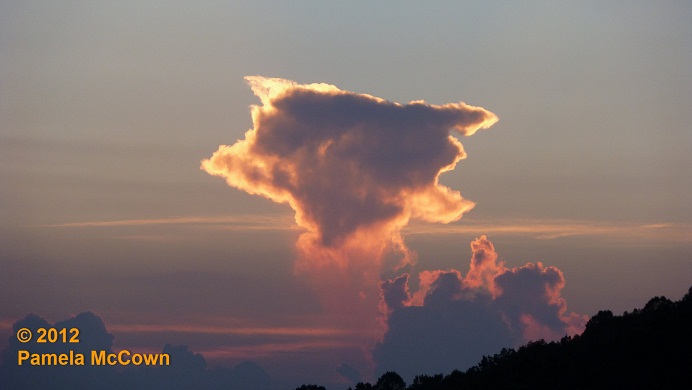
In the image above, the setting sun brought a beautiful glow to the clouds and helped to illuminate what appears to be rain falling from the cloud — but where did the rain go? It seems to disappear before it reaches the ground.
You can see a similar situation with the rain that is falling out of the bottom of the remnants of the thunderstorm in the image below.
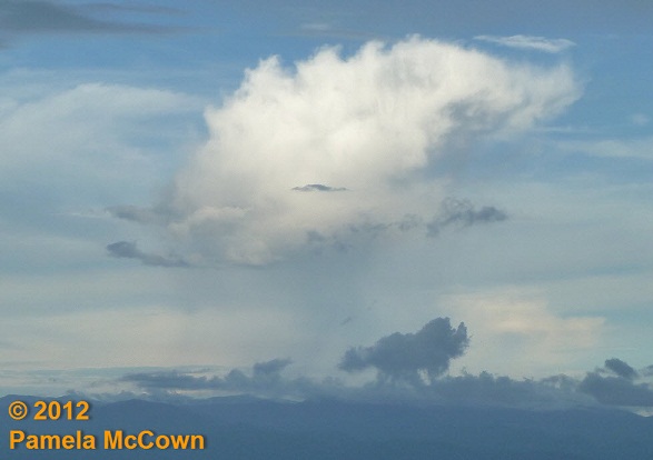
Just 15 minutes earlier, this was a vigorous storm, but as the storm weakened, it eroded from the bottom up — leaving a still menacing looking anvil top … and shafts of virga. Latin for “rod, Virga is precipitation that falls from a cloud but changes into water vapor before it reaches the ground. This occurs when the precipitation — which can be liquid as rain, or frozen as snow or ice — passes through a layer of dry air.
Virga is a fairly common occurrence in Western North Carolina, and is very common in the Western U.S. where the climate is much more arid.
So — the next time you see it, you’ll know what to call it, impressing your friends and family with your geekiness.
A heads-up! We’re working on a very cool addition to the Institute for Climate Education’s web site. Something that will allow you to see Asheville’s weather and climate in a whole new light. I’m very excited about this and will be able to share this new addition with you in the next couple of weeks!